Road signs and what they mean
Every road sign in this chart is federal. The Manual on Uniform Traffic Control Devices (MUTCD) sets the shape, colour and meaning of traffic signs for all 50 states, which is why a stop sign in Ohio is identical to a stop sign in Oregon. What changes from state to state is how signs are tested — some states run a separate signs exam, some require a minimum number of sign answers correct, and most fold them into one knowledge test.
How to read a sign you have never seen
Shape and colour carry meaning before you read a word. That is the point of the system: a driver should know roughly what a sign wants at a distance, in poor light, in a language they may not read well.
Content reviewed against official driver handbooks · August 12, 2026
Regulatory signs

Stop
Come to a complete stop at the stop line or crosswalk, then proceed only when it is safe.

Yield
Slow down and give the right-of-way to traffic and pedestrians; stop if necessary.

Do Not Enter
Do not enter the road or ramp from this direction.

Wrong Way
You are traveling against traffic — turn around; you entered the wrong way.

No U-Turn
You may not make a U-turn at this location.

Speed Limit
The maximum legal speed in ideal conditions; slow down for weather, traffic, or road conditions.

One Way
Traffic flows only in the direction the arrow points.

All Way
Mounted under a STOP sign — every approach to the intersection must stop.

State Law: Yield to Pedestrians
In-street sign requiring drivers to yield to pedestrians within the crosswalk.

State Law: Stop for Pedestrians
In-street sign requiring drivers to stop for pedestrians within the crosswalk.

Truck Speed Limit
The maximum legal speed for trucks, which may be lower than for cars.

Minimum Speed Limit
You must not drive slower than this speed under normal conditions.

Reduced Speed Limit Ahead
A lower speed limit begins ahead; begin slowing down now.

Begin Higher Fines Zone
Traffic fines are increased in the zone that begins here (e.g., work or school zones).

End Higher Fines Zone
Marks the end of the increased-fines zone.

No Right Turn
You may not turn right at this location.

No Left Turn
You may not turn left at this location.

No Turns
Neither left nor right turns are allowed here; continue straight.

Left Lane Must Turn Left
Vehicles in the left lane are required to turn left.

Right Lane Must Turn Right
Vehicles in the right lane are required to turn right.

Intersection Lane Control
Shows which lanes are for turning and which are for going straight at the intersection ahead.

Bike Lane
Marks a lane reserved for bicycles.

No Left or U-Turn
Neither left turns nor U-turns are permitted here.

No Straight Through
You may not continue straight ahead; you must turn.

Do Not Pass
Passing other vehicles is prohibited beyond this sign.

Pass With Care
Passing is allowed again, but only when it is safe.

Slower Traffic Keep Right
Slower vehicles must stay in the right lane so faster traffic can pass.

Begin Right Turn Lane — Yield to Bikes
A right-turn lane begins; yield to bicycles that may be continuing straight.

Trucks Use Right Lane
Trucks must travel in the right lane.

Keep Right
Keep to the right of a median, island, or obstruction.

Keep Left
Keep to the left of a median, island, or obstruction.

Keep Right Except to Pass
Stay in the right lane except when passing.

Do Not Drive on Shoulder
Driving on the shoulder is prohibited.

No Trucks
Trucks are not allowed on this road.

No Motor Vehicles
Motor vehicles are not allowed; this route may be for non-motorized use.

No Bicycles
Bicycles are not allowed on this road.

No Pedestrians, Bicycles, or Motor-Driven Cycles
Pedestrians, bicycles, and motor-driven cycles may not use this freeway.

No Parking Any Time
Parking is prohibited here at all times.

Accessible Parking
Parking reserved for vehicles displaying a disability permit.

No Parking Bus Stop
Parking is prohibited because this is a bus stop.

No Parking
Parking is not allowed in the indicated area.

Stop Here on Red
When the traffic signal is red, stop at this sign.

Do Not Block Intersection
Do not enter the intersection unless you can clear it before the light changes.

No Turn on Red
You may not turn while the traffic signal is red.

Left Turn Yield on Green
On a green light, left-turning drivers must yield to oncoming traffic.

Road Closed
The road is closed to all traffic.

Road Closed — Local Traffic Only
The road ahead is closed except for local traffic.

Road Closed to Thru Traffic
Through traffic may not use this road; local access only.

Weight Limit
Vehicles over the posted weight may not use this road or bridge.

No Hazardous Materials
Vehicles carrying hazardous materials are prohibited.
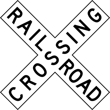
Railroad Crossing (Crossbuck)
Marks the exact point where tracks cross the road. Treat it like a yield sign: slow down, look and listen, and stop if a train is coming.
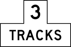
Number of Tracks
A plaque under the crossbuck showing how many tracks cross here; after one train passes, check for another.
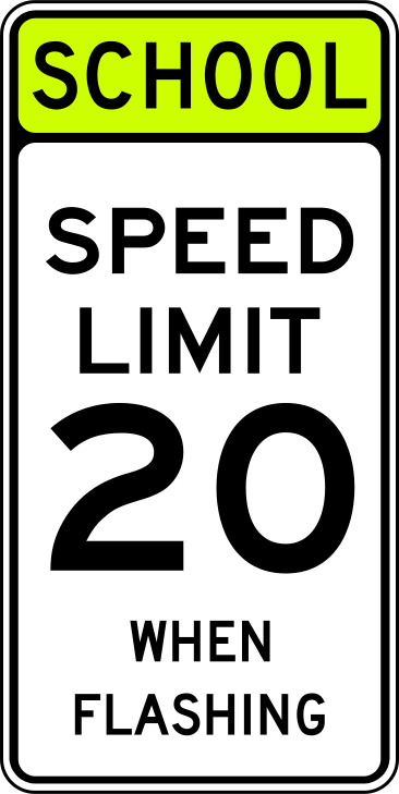
School Speed Limit When Flashing
The lower school-zone speed limit is in force whenever the yellow lights are flashing.
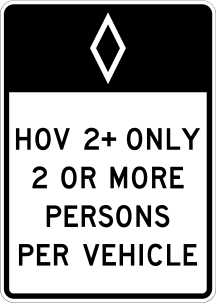
HOV Lane
Only vehicles carrying at least the posted number of people may use this lane during the hours shown.

Exempt
A white plaque mounted below a crossbuck; it tells drivers who are normally required to stop at railroad crossings (buses, hazardous-materials carriers) that this particular crossing does not require a stop.
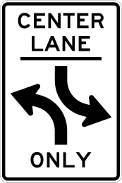
Two-Way Left Turn Only
Marks a center lane shared by traffic from both directions; enter it only to turn left or to complete a left turn from a driveway, and never use it for through travel or passing.
Warning signs

Turn Ahead
A sharp turn in the road is ahead in the direction of the arrow.

Stop Ahead
A stop sign is ahead; prepare to stop.

Signal Ahead
A traffic signal is ahead; prepare to slow or stop.

Pedestrian Crossing
Watch for people crossing; be ready to stop and yield.

Curve
The road curves gently ahead in the direction shown.

Reverse Turn
A sharp turn in one direction followed immediately by a sharp turn in the other.

Reverse Curve
A curve in one direction followed by a curve in the opposite direction.

Winding Road
A series of three or more curves is ahead.

One-Direction Large Arrow
The road turns sharply; follow the direction of the large arrow.

Two-Direction Large Arrow
Traffic may go in either direction shown; often at a T-intersection or median.

Chevron Alignment
Marks a sharp change in roadway direction along a curve.

Hairpin Curve
An extremely sharp curve that doubles back on itself is ahead.

Cross Road
A crossroad intersection is ahead; watch for entering traffic.

Side Road
Another road joins from the side ahead; watch for entering traffic.

Roundabout Ahead
A roundabout (circular intersection) is ahead; slow down and prepare to yield.

Yield Ahead
A yield sign is ahead; be prepared to yield.

Be Prepared to Stop
Traffic may be stopping ahead; be ready to stop.

Reduced Speed Limit Ahead
A lower speed limit begins ahead; slow down.

Merging Traffic
Traffic merges from the side ahead; adjust speed to allow vehicles to merge.

Lane Ends
A traffic lane ends ahead; merge with the adjacent lane.

Added Lane
A new lane is added ahead; merging is not required.

Lanes Merge
Two lanes merge into one ahead; adjust speed and position.

Road Narrows
The roadway becomes narrower ahead.

Narrow Bridge
A bridge ahead is only slightly wider than the roadway.

One Lane Bridge
The bridge ahead carries only one lane; only one direction can cross at a time.

Ramp Narrows
The ramp becomes narrower ahead.

Divided Highway Begins
The road ahead is divided by a median; keep right.

Divided Highway Ends
The divided road ends ahead; two-way traffic resumes.

Two-Way Traffic
Two-way traffic is ahead; oncoming vehicles share the road.

Hill / Steep Grade
A steep downgrade is ahead; use a lower gear and check your brakes.

Bump
There is a bump or raised surface in the road ahead.

Dip
There is a low place or dip in the road ahead.

Pavement Ends
The paved road ends ahead and becomes gravel or dirt.

Soft Shoulder
The shoulder is soft; do not leave the pavement.

Slippery When Wet
The road is slippery when wet; slow down and avoid hard braking.

Loose Gravel
Loose gravel is on the road ahead; reduce speed to keep control.

Rough Road
The road surface ahead is rough or broken.

Low Shoulder
The shoulder is lower than the pavement; use care if you leave the lane.

Uneven Lanes
There is a height difference between lanes, often during repaving.

Grooved Pavement
The pavement is grooved; motorcyclists especially should use care.

Metal Bridge Deck
The bridge has a metal deck that can be slippery when wet.

Railroad Crossing Ahead
A railroad crossing is ahead; slow down and be ready to stop for trains.

Bicycle Crossing
Watch for bicycles crossing or sharing the road ahead.

Deer Crossing
Deer may cross the road ahead; be alert, especially at dawn and dusk.

Cattle Crossing
Livestock may be on or crossing the road ahead.

Farm Machinery
Slow-moving farm equipment may be on the road ahead.

Snowmobile Crossing
Snowmobiles may cross the road ahead.

Equestrian Crossing
Watch for horseback riders crossing the road ahead.

Persons with Disabilities
Watch for pedestrians with disabilities who may be crossing.

Golf Cart Crossing
Golf carts may cross the road ahead.

Horse-Drawn Vehicle Crossing
Slow-moving horse-drawn vehicles may be on or crossing the road ahead.

Low Clearance
The overpass or structure ahead has limited height clearance.

Advisory Speed
The recommended safe speed for the curve or feature ahead.

Dead End
The road ahead ends and does not connect to another road.

No Outlet
The road ahead connects only to dead-end streets.

No Passing Zone
You are entering a no-passing zone; do not pass other vehicles.

Playground
A playground is near the road ahead; watch for children.

Speed Hump
A raised speed hump is ahead; slow down.

School
You are approaching a school zone or school crossing; watch for children.

Truck Rollover
The curve ahead is sharp enough to tip a tall or heavy vehicle; trucks should slow well before it.

Bridge Ices Before Road
Bridges freeze before the road does; expect ice on the bridge ahead in cold weather.

Road May Flood
This stretch floods in heavy rain; never drive into water whose depth you cannot judge.
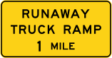
Runaway Truck Ramp
Warns that an escape ramp for trucks with failed brakes is ahead on a steep downgrade; a heavy vehicle losing control should use it rather than keep going down the grade.
Construction & work-zone signs

Road Work Ahead
A work zone is ahead; slow down and watch for workers and equipment.

Detour
Follow the detour route around a closed or restricted road.
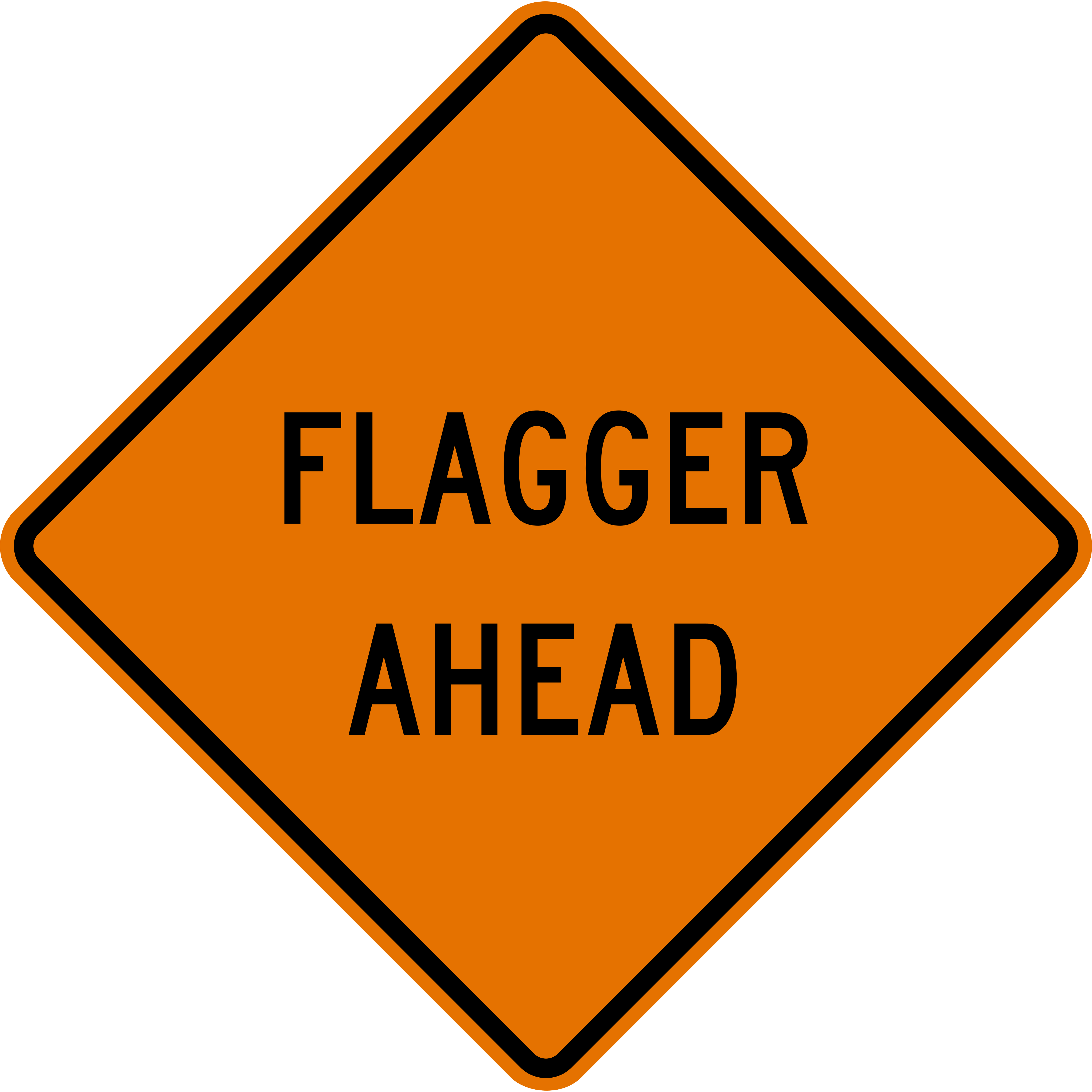
Flagger Ahead
A flagger is directing traffic in the work zone ahead; slow down and obey their signals.
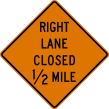
Right Lane Closed Ahead
The right lane ends in the work zone ahead; merge left early and smoothly.
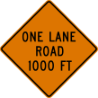
One Lane Road Ahead
Traffic in both directions must share a single lane ahead; be ready to stop for a flagger or signal.

Shoulder Work
Crews are working on the shoulder ahead; stay in your lane and give them room.
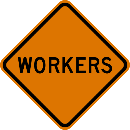
Workers
People are working on or beside the road ahead; slow down and watch for them.

End Road Work
The work zone ends here; normal speed limits and rules apply again.
Guide signs

Interstate Route Marker
Identifies an Interstate highway by number (red, white, and blue shield).

U.S. Route Marker
Identifies a U.S. numbered highway (black-and-white shield).

State Route Marker
Identifies a state highway; the design varies by state.

County Route Marker
Identifies a county road (blue-and-yellow pentagon marker).
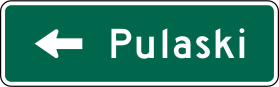
Destination Guide
A green guide sign naming a place ahead and the direction or distance to reach it.
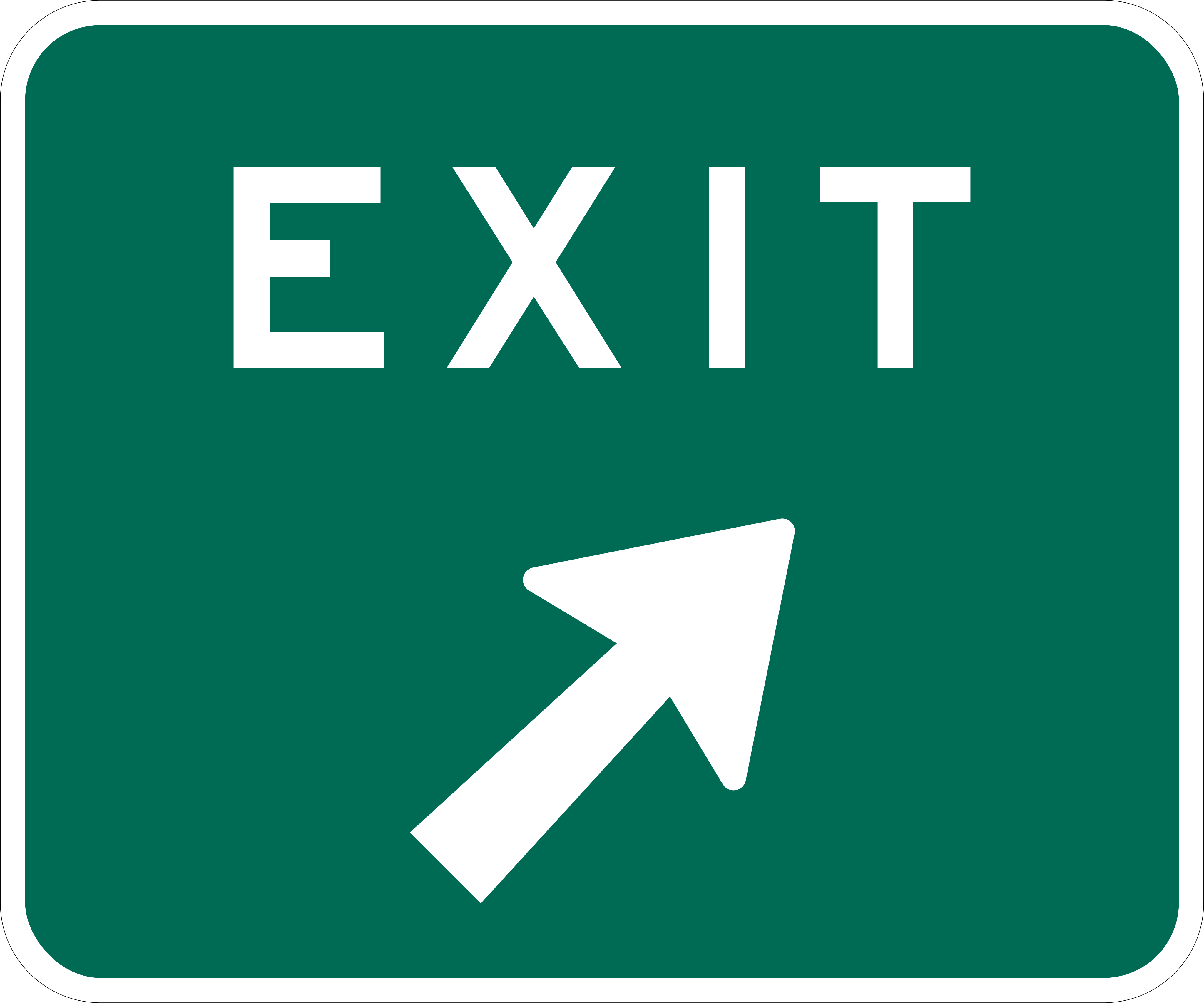
Exit
Marks where an exit ramp leaves the highway; move into the exit lane before you reach it.

Street Name
Identifies the cross street at an intersection so you can find your turn in time.

Picnic Shelter (Recreation Area)
A brown sign points to a park, campground, trail or other recreational or cultural site — here, sheltered picnic tables.
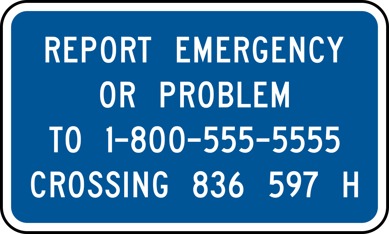
Emergency Notification System
Posted at railroad crossings, this blue sign lists a phone number and crossing ID number to report a stalled vehicle, blocked crossing, or malfunctioning signal.
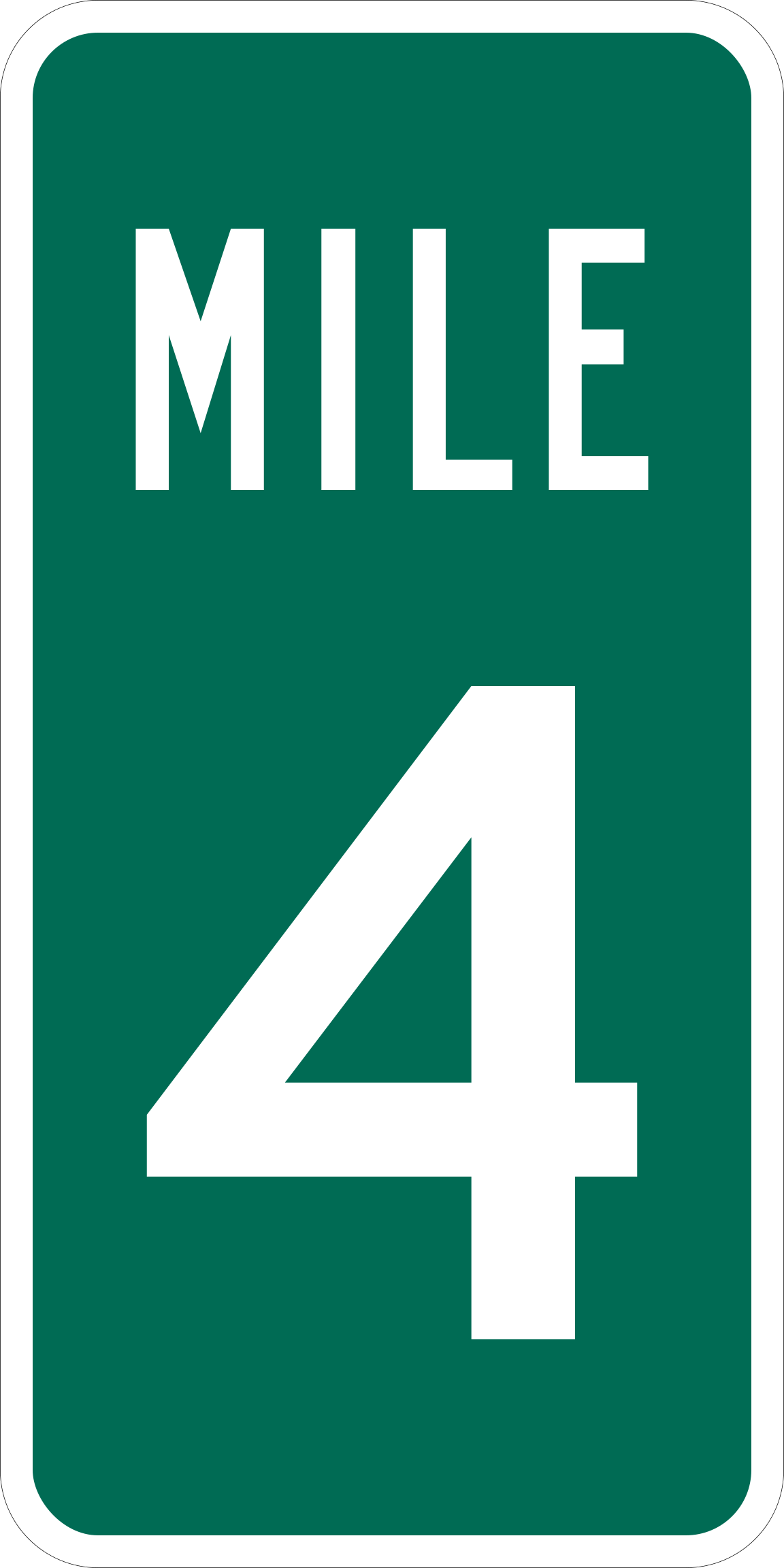
Reference Location Sign (Mile Marker)
A small green post sign showing the distance in miles from the state line or route start; use it to tell 911 or roadside assistance exactly where you are.
Service & information signs

Telephone
A public or emergency telephone is available at the next exit or area.

Hospital
A hospital with emergency medical services is nearby.

Camping
A camping area is available nearby.

Accessible Facilities
Facilities accessible to people with disabilities are available.

Gas
A fuel station is available at the next exit or area.

Food
Restaurants or food services are available nearby.

Lodging
Hotels or motels are available nearby.

RV Sanitary Station
A sanitary dump station for recreational vehicles is available.

Alternative Fuels
Alternative fuel (such as EV charging) is available nearby.
How signs are tested in your state
Sign meanings are national. Sign testing is not. Pick your state for its exam structure, its handbook chapter, and its own practice questions.
- California
- Texas
- Florida
- New York
- Georgia
- Pennsylvania
- Illinois
- Ohio
- North Carolina
- Michigan
- New Jersey
- Virginia
- Washington
- Arizona
- Massachusetts
- Tennessee
- Indiana
- Missouri
- Maryland
- Wisconsin
- Colorado
- Minnesota
- South Carolina
- Alabama
- Louisiana
- Kentucky
- Oregon
- Oklahoma
- Connecticut
- Utah
- Nevada
- Arkansas
- Mississippi
- Kansas
- Iowa
- New Mexico
- Nebraska
- Idaho
- West Virginia
- Hawaii
- New Hampshire
- Maine
- Montana
- Rhode Island
- Delaware
- South Dakota
- North Dakota
- Alaska
- Vermont
- Wyoming